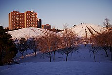
Category:Cerro del Tío Pío
Jump to navigation
Jump to search
| Object location | | View all coordinates using: OpenStreetMap |
|---|
park in Puente de Vallecas, Spain | |||||
| Upload media | |||||
| Instance of | |||||
|---|---|---|---|---|---|
| Location | |||||
| Date of official opening |
| ||||
| official website | |||||
 | |||||
Subcategories
This category has the following 2 subcategories, out of 2 total.
R
- Rectángulo real ilusorio (4 F)
V
- Views from Cerro del Tío Pío (15 F)
Media in category "Cerro del Tío Pío"
The following 34 files are in this category, out of 34 total.
-
Cerro del Tío Pío - 001.jpg 4,657 × 3,146; 1.87 MB
-
Cerro del Tío Pío - 002.jpg 4,807 × 3,209; 2.46 MB
-
Cerro del Tío Pío.jpg 11,232 × 3,136; 13.21 MB
-
Cerro-del-Tío-Pío-2021 01 12-01.webm 10 s, 1,920 × 1,080; 21.86 MB
-
Cerro-del-Tío-Pío-2021 01 12-02.webm 5.0 s, 1,920 × 1,080; 6.19 MB
-
Madrid (Spain) (33807668821).jpg 5,150 × 3,718; 16.7 MB
-
Madrid (Spain) (33896846436).jpg 5,216 × 3,920; 17.35 MB
-
Madrid (Spain) (33937689825).jpg 5,216 × 3,920; 20.11 MB
-
Madrid - 31473356556.jpg 4,809 × 3,210; 2.22 MB
-
Música clásica y poesía para despedir el sol de verano 02.jpg 1,500 × 857; 166 KB
-
Parque de las Siete Tetas (Cerro del Tío Pío, Madrid) 2021-01-12 - 50829012878.jpg 4,875 × 3,255; 1.35 MB
-
Parque de las Siete Tetas (Cerro del Tío Pío, Madrid) 2021-01-12 - 50829055083.jpg 4,867 × 3,249; 1.28 MB
-
Parque de las Siete Tetas (Cerro del Tío Pío, Madrid) 2021-01-12 - 50829856022.jpg 4,863 × 3,247; 1.5 MB
-
Parque de las Siete Tetas (Cerro del Tío Pío, Madrid) 2021-01-12 - 50829860997.jpg 4,869 × 3,250; 1.79 MB
-
Parque de las Siete Tetas (Cerro del Tío Pío, Madrid) 2021-01-12 - 51005086233.jpg 4,881 × 3,259; 1.24 MB
-
Parque de las Siete Tetas (Cerro del Tío Pío, Madrid) 2021-01-12 - 51005782641.jpg 4,875 × 3,255; 1.88 MB
-
Parque de las Siete Tetas (Cerro del Tío Pío, Madrid) 2021-01-12 - 51005896362.jpg 4,881 × 3,259; 1.39 MB
-
Parque de las Siete Tetas (Cerro del Tío Pío, Madrid) 2021-01-12 - 51005907912.jpg 4,877 × 3,256; 1.62 MB
-
Puente de Vallecas - Aerial photograph (color, contrast, tone).jpg 2,592 × 1,944; 4.84 MB
-
Tetas de vallecas (10).jpg 1,200 × 1,600; 1.17 MB
-
Tetas de vallecas (11).jpg 1,200 × 1,600; 1.33 MB
-
Tetas de vallecas (12).jpg 1,200 × 1,600; 1.52 MB
-
Tetas de vallecas (2).jpg 1,600 × 1,200; 872 KB
-
Tetas de vallecas (3).jpg 1,600 × 1,200; 877 KB
-
Tetas de vallecas (4).jpg 1,600 × 1,200; 875 KB
-
Tetas de vallecas (6).jpg 1,200 × 1,600; 1.27 MB
-
Tetas de vallecas (7).jpg 1,600 × 1,200; 906 KB
-
Tetas de vallecas (8).jpg 1,600 × 1,200; 864 KB
-
Tetas de vallecas (9).jpg 1,200 × 1,600; 823 KB
-
Tetas de vallecas.jpg 1,600 × 1,200; 829 KB
-
Unnamed1 - panoramio (2165).jpg 4,768 × 3,836; 13.06 MB
-
Unnamed2 - panoramio (4658).jpg 7,360 × 4,912; 17.63 MB
-
Vista del Cerro del Tío Pío.jpg 2,945 × 1,958; 2.22 MB


